চিত্ৰ:Nagaland locator map.svg

Size of this PNG preview of this SVG file: 734 × 600 পিক্সেল. আন ৰিজ'লিউশ্যনসমূহ: 294 × 240 পিক্সেল | 587 × 480 পিক্সেল | 940 × 768 পিক্সেল | 1,253 × 1,024 পিক্সেল | 2,506 × 2,048 পিক্সেল | 2,393 × 1,956 পিক্সেল।
মূল ফাইল (SVG ফাইল, সাধাৰণতঃ 2,393 × 1,956 পিক্সেল, ফাইল মাত্ৰা: 277 KB)
| এই ফাইলটো ৱিকিমিডিয়া কমন্সৰ পৰা আমদানি কৰা হৈছে। ফাইল বিৱৰণ পৃষ্ঠাৰ সবিশেষ তথ্য তলত উল্লেখ কৰা হ’ল ।
|
| শিৰোনাম |
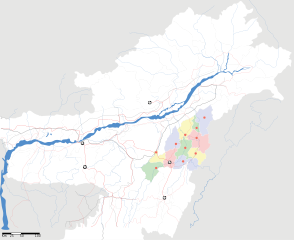
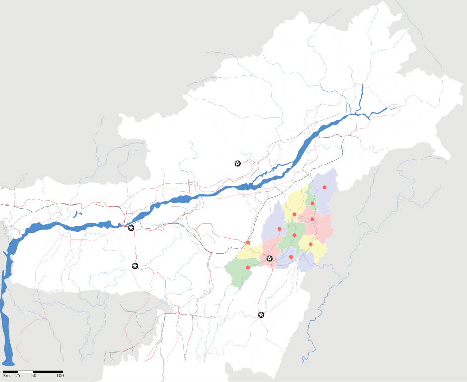
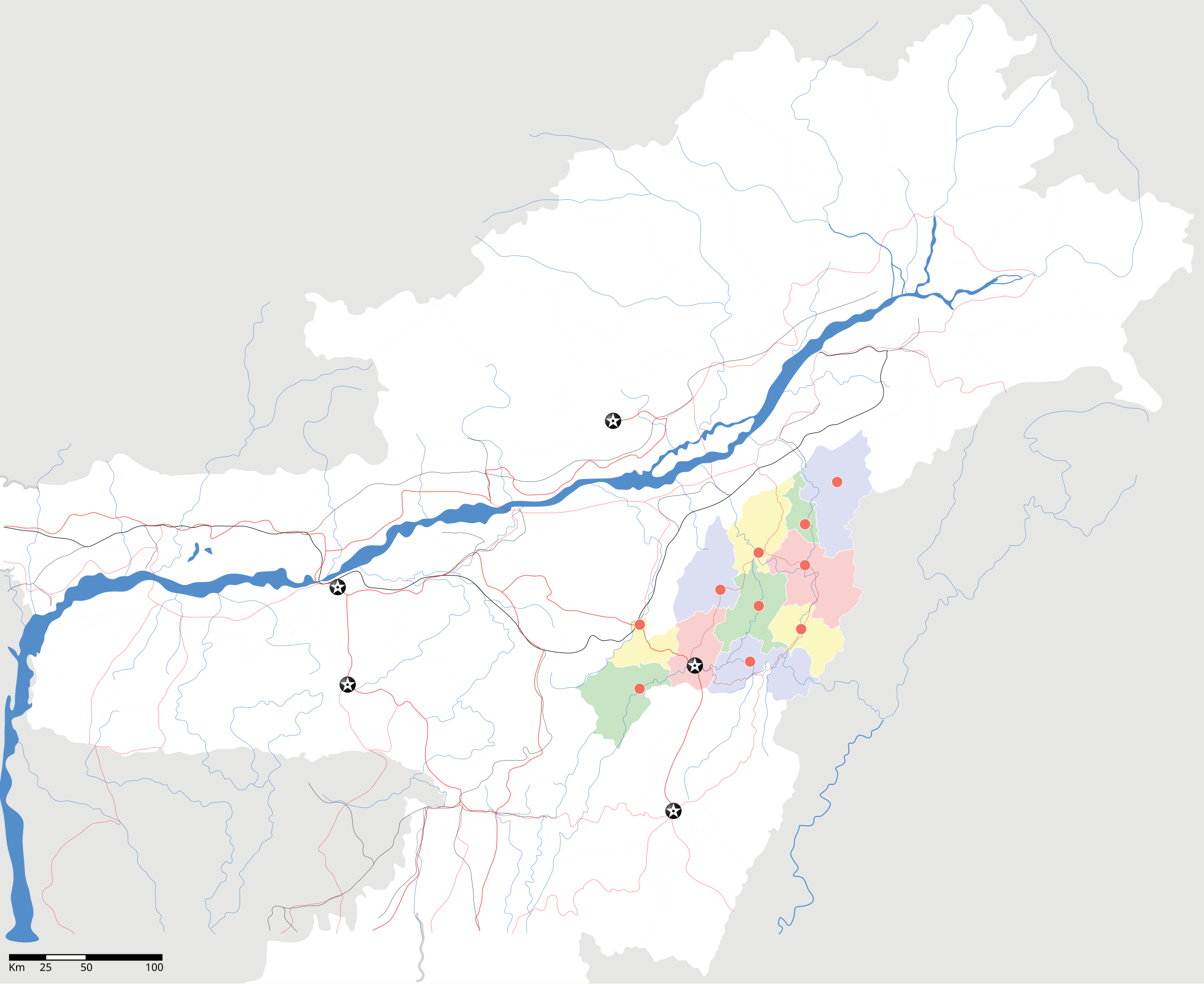
Nagaland locator Map |
| Description |
Map of w:Nagaland with road and rail lines. Equirectangular projection. Geographic limits of the map: top=29.49, bottom=23.74, left=89.61, right=97.52. |
| তাৰিখ | |
| উৎস |
নিজা কাৰ্য |
| স্ৰষ্টা | |
| অনুমতি (এই ফাইলৰ পুনঃব্যৱহাৰ) |
মই, এই কামৰ স্বত্বাধিকাৰী, ইয়াৰ দ্বাৰা মই এই কামক তলত বৰ্ননা দিয়া অনুজ্ঞাপত্ৰৰ অধীনত প্ৰকাশ কৰিলো: এই ফাইলটো ক্ৰিয়েটিভ কমন্স এট্ৰিবইউচন-চেয়াৰ এলাইক ৩.০ আন্প'ৰ্টেড অনুজ্ঞাপত্ৰৰ অধীনত।
|
| Geotemporal data | |
| Date depicted | second half of 20 century আৰু 21 century |
| Georeferencing | If inappropriate please set warp_status = skip to hide. |
| Archival data | |
| টোকা | Part of WikiProject India Maps |
ফাইলৰ ইতিবৃত্ত
ফাইলৰ আগৰ অৱস্থা চাবলৈ সেই তাৰিখ/সময়ত ক্লিক কৰক।
| তাৰিখ/সময় | ক্ষুদ্ৰ প্ৰতিকৃতি | আকাৰ | সদস্য | মন্তব্য | |
|---|---|---|---|---|---|
| বৰ্তমান | 12:05, 17 April 2007 | | 2,393 × 1,956 (277 KB) | Planemad | not displaying, reupload |
| 12:00, 17 April 2007 |  | 2,393 × 1,956 (277 KB) | Planemad | not displaying, reupload | |
| 11:55, 17 April 2007 |  | 2,393 × 1,956 (277 KB) | Planemad | {{WikiProject_India_Maps |Title=Nagaland locator Map |Description=Map of w:Nagaland with road and rail lines |Source= [http://www.iitg.ernet.in/rcilts/assam_political.jpg IIT Guwahati - Assam Political map], [http://nagaland.nic.in/planning&coord/p |
ফাইল ব্যৱহাৰ
ফাইলৰ গোলকীয় ব্যৱহাৰ
তলত দিয়া আন ৱিকিসমূহে এই ফাইলটো ব্যৱহাৰ কৰে:
- ar.wikipedia.org-ৰ ব্যৱহাৰ
- ast.wikipedia.org-ৰ ব্যৱহাৰ
- ba.wikipedia.org-ৰ ব্যৱহাৰ
- bh.wikipedia.org-ৰ ব্যৱহাৰ
- bn.wikipedia.org-ৰ ব্যৱহাৰ
- ceb.wikipedia.org-ৰ ব্যৱহাৰ
- de.wikipedia.org-ৰ ব্যৱহাৰ
- en.wikipedia.org-ৰ ব্যৱহাৰ
- en.wikinews.org-ৰ ব্যৱহাৰ
- es.wikipedia.org-ৰ ব্যৱহাৰ
- fa.wikipedia.org-ৰ ব্যৱহাৰ
- hi.wikipedia.org-ৰ ব্যৱহাৰ
- ja.wikipedia.org-ৰ ব্যৱহাৰ
- kbd.wikipedia.org-ৰ ব্যৱহাৰ
- ml.wikipedia.org-ৰ ব্যৱহাৰ
- nl.wikipedia.org-ৰ ব্যৱহাৰ
- or.wikipedia.org-ৰ ব্যৱহাৰ
- pam.wikipedia.org-ৰ ব্যৱহাৰ
- pa.wikipedia.org-ৰ ব্যৱহাৰ
- pnb.wikipedia.org-ৰ ব্যৱহাৰ
- sa.wikipedia.org-ৰ ব্যৱহাৰ
- sw.wikipedia.org-ৰ ব্যৱহাৰ
- ta.wikipedia.org-ৰ ব্যৱহাৰ
- tr.wikipedia.org-ৰ ব্যৱহাৰ
- vi.wikipedia.org-ৰ ব্যৱহাৰ
- war.wikipedia.org-ৰ ব্যৱহাৰ
- www.wikidata.org-ৰ ব্যৱহাৰ
- yo.wikipedia.org-ৰ ব্যৱহাৰ
- zh.wikipedia.org-ৰ ব্যৱহাৰ