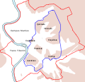
চিত্ৰ:Roma Plan.jpg

এই খচৰাৰ আকাৰ: 754 × 600 পিক্সেল. আন ৰিজ'লিউশ্যনসমূহ: 302 × 240 পিক্সেল | 604 × 480 পিক্সেল | 966 × 768 পিক্সেল | 1,280 × 1,018 পিক্সেল | 1,840 × 1,463 পিক্সেল।
মূল ফাইল (1,840 × 1,463 পিক্সেল, ফাইলৰ মাত্ৰা: 2.5 MB, MIME প্ৰকাৰ: image/jpeg)
ফাইলৰ ইতিবৃত্ত
ফাইলৰ আগৰ অৱস্থা চাবলৈ সেই তাৰিখ/সময়ত ক্লিক কৰক।
| তাৰিখ/সময় | ক্ষুদ্ৰ প্ৰতিকৃতি | আকাৰ | সদস্য | মন্তব্য | |
|---|---|---|---|---|---|
| বৰ্তমান | 16:14, 30 March 2015 |  | 1,840 × 1,463 (2.5 MB) | Jonstevn | Reverted to version as of 19:01, 28 August 2006 |
| 16:10, 30 March 2015 |  | 1,840 × 1,463 (2.5 MB) | Jonstevn | Reverted to version as of 19:01, 28 August 2006 | |
| 16:10, 30 March 2015 |  | 1,840 × 1,463 (2.5 MB) | Jonstevn | Reverted to version as of 19:01, 28 August 2006 | |
| 06:40, 27 July 2008 |  | 1,840 × 1,463 (3.38 MB) | Amadscientist | {{Information |Description= |Source= |Date= |Author= |Permission= |other_versions= }} | |
| 04:57, 27 July 2008 |  | 4,000 × 3,180 (12.21 MB) | Amadscientist | {{Information |Description= |Source= |Date= |Author= |Permission= |other_versions= }} | |
| 19:01, 28 August 2006 |  | 1,840 × 1,463 (2.5 MB) | Nikephoros | {{Information |Description=Plan Roms im Altertum / Map of Rome during Antiquity |Source=G. Droysens Allgemeiner Historischer Handatlas |Date=1886 |Author=? |Permission= not needed |other_versions= no }} |
ফাইল ব্যৱহাৰ
তলত দিয়া 3 পৃষ্ঠাবোৰে এই ফাইলটো ব্যৱহাৰ কৰে:
ফাইলৰ গোলকীয় ব্যৱহাৰ
তলত দিয়া আন ৱিকিসমূহে এই ফাইলটো ব্যৱহাৰ কৰে:
- ar.wikipedia.org-ৰ ব্যৱহাৰ
- azb.wikipedia.org-ৰ ব্যৱহাৰ
- beta.wikiversity.org-ৰ ব্যৱহাৰ
- bg.wikipedia.org-ৰ ব্যৱহাৰ
- bn.wikipedia.org-ৰ ব্যৱহাৰ
- bs.wikipedia.org-ৰ ব্যৱহাৰ
- bxr.wikipedia.org-ৰ ব্যৱহাৰ
- ca.wikipedia.org-ৰ ব্যৱহাৰ
- ceb.wikipedia.org-ৰ ব্যৱহাৰ
- cs.wikipedia.org-ৰ ব্যৱহাৰ
- de.wikipedia.org-ৰ ব্যৱহাৰ
এই ফাইলটোৰ অধিক গোলকীয় ব্যৱহাৰ চাওক।


