চিত্ৰ:St James Church, Bix Bottom - geograph.org.uk - 557771.jpg
ইয়াতকৈ ডাঙৰকৈ দেখুৱাব নোৱাৰি ।
St_James_Church,_Bix_Bottom_-_geograph.org.uk_-_557771.jpg (640 × 477 পিক্সেল, ফাইলৰ মাত্ৰা: 141 KB, MIME প্ৰকাৰ: image/jpeg)
| এই ফাইলটো ৱিকিমিডিয়া কমন্সৰ পৰা আমদানি কৰা হৈছে। ফাইল বিৱৰণ পৃষ্ঠাৰ সবিশেষ তথ্য তলত উল্লেখ কৰা হ’ল ।
|
সাৰাংশ
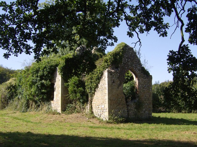
| বিৱৰণ |
English: Bix, South Oxfordshire, England: ruins of the old St James's parish church, abandoned in 1875 |
| তাৰিখ | |
| উৎস | From geograph.org.uk |
| লেখক | Graham Horn |
| স্বীকৃতিপ্ৰদান (required by the license) | Graham Horn / St James Church, Bix Bottom / |
| Camera location | | View this and other nearby images on: OpenStreetMap |
|---|
_heading:315.00&language=as)
| Object location | | View this and other nearby images on: OpenStreetMap |
|---|
_heading:315.00&language=as)
অনুজ্ঞাপত্ৰ

|
This image was taken from the Geograph project collection. See this photograph's page on the Geograph website for the photographer's contact details. The copyright on this image is owned by Graham Horn and is licensed for reuse under the Creative Commons Attribution-ShareAlike 2.0 license.
|
This file is licensed under the Creative Commons Attribution-Share Alike 2.0 Generic license.
স্বীকৃতিপ্ৰদান: Graham Horn
- আপুনি স্বাধীনভাৱে:
- বিতৰণ কৰিব পাৰে – কামটো নকল (কপি), বিতৰণ আৰু প্ৰেৰণ কৰিবলৈ
- পুনৰ্মিশ্ৰণ কৰিবলৈ – কামটো অভিযোজন কৰিবলৈ
- তলত উল্লেখ কৰা চৰ্ত্তসমূহৰ ভিত্তিত:
- স্বীকৃতিপ্ৰদান – আপুনি প্ৰয়োজনীয় স্বীকৃতি দিয়াৰ লগতে অনুজ্ঞাপত্ৰলৈ লিংক আৰু কোনো সালসলনিৰ ইংগিত দিব লাগিব। আপুনি এয়া উপযুক্ত ধৰণেৰে দিব পাৰে, মাত্ৰ অনুজ্ঞাপত্ৰধাৰীয়ে আপোনাক বা আপোনাৰ কামক মঞ্জুৰী জনোৱাৰ দৰে নিলিখিব।
- একে ধৰণে চেয়াৰ কৰক – যদি আপুনি এই কামটো পৰিবৰ্তন, ৰূপান্তৰ বা এই কামটোৰ উপৰত ভিত্তি কৰি নতুন সৃষ্টিকৰ্ম তৈয়াৰ কৰে, আপুনি শেষৰ কৰ্মটো পূৰ্বৰ কৰ্মটোৰ সৈতে একে বা একেধৰণৰ অনুজ্ঞাপত্ৰৰ আওতাত বিতৰণ কৰিব পাৰে।
ফাইলৰ ইতিবৃত্ত
ফাইলৰ আগৰ অৱস্থা চাবলৈ সেই তাৰিখ/সময়ত ক্লিক কৰক।
| তাৰিখ/সময় | ক্ষুদ্ৰ প্ৰতিকৃতি | আকাৰ | সদস্য | মন্তব্য | |
|---|---|---|---|---|---|
| বৰ্তমান | 04:11, 6 February 2011 | | 640 × 477 (141 KB) | GeographBot | == {{int:filedesc}} == {{Information |description={{en|1=St James Church, Bix Bottom The ruins of the parish church, last used in 1874. These are now considerably more overgrown than Andrew Smith's picture of nearly two years earlier [86958]}} |date= |
ফাইল ব্যৱহাৰ
তলত দিয়া পৃষ্ঠাটোৱে এই ফাইলটো ব্যৱহাৰ কৰে:
ফাইলৰ গোলকীয় ব্যৱহাৰ
তলত দিয়া আন ৱিকিসমূহে এই ফাইলটো ব্যৱহাৰ কৰে:
- ca.wikipedia.org-ৰ ব্যৱহাৰ
- de.wikipedia.org-ৰ ব্যৱহাৰ
- en.wikipedia.org-ৰ ব্যৱহাৰ
- es.wikipedia.org-ৰ ব্যৱহাৰ
- fr.wikipedia.org-ৰ ব্যৱহাৰ
- he.wikipedia.org-ৰ ব্যৱহাৰ
- pt.wikipedia.org-ৰ ব্যৱহাৰ
- sv.wikipedia.org-ৰ ব্যৱহাৰ
- www.wikidata.org-ৰ ব্যৱহাৰ