Module:Location map/data/Japan/doc
This is the documentation page for Module:Location map/data/Japan
|
|
This template is used on 4,100+ pages, and changes to it will be widely noticed. Please test any changes in the template's /sandbox or /testcases subpages, or in a user subpage, and consider discussing changes at the talk page before implementing them. |
| name | Japan | ||
|---|---|---|---|
| x | 100*(($1>30.90)*($2-128.24)/(149.27-128.24)+($1<=30.90)*($2-110.43)/(131.44-110.43)) | ||
| y | 100*(($1>30.90)*($1-45.86)/(30.02-45.86)+($1<=30.90)*($1-39.54)/(23.71-39.54)) | ||
| image | Japan location map with side map of the Ryukyu Islands.svg
| ||

| |||
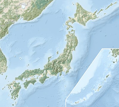
| image1 | Japan natural location map with side map of the Ryukyu Islands.jpg
| ||

| |||
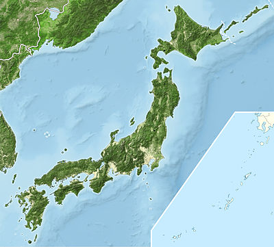
| image2 | Japan bluemarble location map with side map of the Ryukyu Islands.jpg
| ||

| |||

Module:Location map/data/Japan is a location map definition used to overlay markers and labels on an equirectangular projection map of Japan. The markers are placed by latitude and longitude coordinates on the default map or a similar map image.
Usage
These definitions are used by the following templates when invoked with parameter "Japan":
{{Location map | Japan | ...}}{{Location map many | Japan | ...}}{{Location map+ | Japan | ...}}{{Location map~ | Japan | ...}}
Map definition
name = Japan- Name used in the default map caption
image = Japan location map with side map of the Ryukyu Islands.svg- The default map image, without "Image:" or "File:"
image1 = Japan natural location map with side map of the Ryukyu Islands.jpg- An alternative map image, usually a relief map, can be displayed via the relief or AlternativeMap parameters
image2 = Japan bluemarble location map with side map of the Ryukyu Islands.jpg- A second alternative map image, can be displayed via the AlternativeMap parameter only
x = 100*(($1>30.90)*($2-128.24)/(149.27-128.24)+($1<=30.90)*($2-110.43)/(131.44-110.43))- An expression to calculate a location on the map via its longitude; evaluates as 0 along the left edge and 100 along the right edge
y = 100*(($1>30.90)*($1-45.86)/(30.02-45.86)+($1<=30.90)*($1-39.54)/(23.71-39.54))- An expression to calculate a location on the map via its latitude; evaluates as 0 along the top edge and 100 along the bottom edge
Alternative map
The map defined as image1 (Japan natural location map with side map of the Ryukyu Islands.jpg) can be displayed by using the relief or AlternativeMap parameters in {{Location map}}, {{Location map many}} and {{Location map+}}. The map defined as image2 (Japan bluemarble location map with side map of the Ryukyu Islands.jpg) can only be displayed by using the AlternativeMap parameter. The use of these two parameters is shown in the examples below. Additional examples can be found at:
Examples using location map templates
Location map, using default map (image)
{{Location map |Japan
|label = Fukuoka
|coordinates = {{coord|33|35|N|130|24|E|display=inline}}
}}
Location map many, using relief map (image1)
{{Location map many |Japan
|relief = yes
|caption = Locations in [[Japan]] and [[Ryukyu Islands]]
|background = lightgrey
|label1 = Fukuoka
|coordinates1 = {{coord|33|35|N|130|24|E|display=inline}}
|label2 = Naha
|coordinates2 = {{coord|26|12|N|127|41|E|display=inline}}
}}
Location map+, using AlternativeMap
{{Location map+ |Japan
|AlternativeMap = Japan bluemarble location map with
                  side map of the Ryukyu Islands.jpg
|caption = Locations in [[Japan]] and [[Ryukyu Islands]]
|places =
  {{Location map~ |Japan
  |background = lightgrey
  |label = Fukuoka
  |coordinates = {{coord|33|35|N|130|24|E|display=inline}}
  }}
  {{Location map~ |Japan
  |label = Naha
  |coordinates = {{coord|26|12|N|127|41|E|display=inline}}
  }}
}}
Examples using Infobox settlement
Main islands north of 30.90°N, with default map image
Fukuoka | |
|---|---|
| স্থানাংক: 33°35′N 130°24′E / 33.583°N 130.4°E | |
| Country | Japan |
| Region | Kyūshū |
| Prefecture | Fukuoka |
{{Infobox settlement
|name               = Fukuoka
|subdivision_type   = Country
|subdivision_name   = Japan
|subdivision_type1  = Region
|subdivision_name1  = Kyūshū
|subdivision_type2  = Prefecture
|subdivision_name2  = Fukuoka
|pushpin_map        = Japan
|coordinates        = {{coord|33|35|N|130|24|E|region:JP|display=inline}}
}}
Ryukyu Islands south of 30.90°N, with alternative map image
Naha | |
|---|---|
| স্থানাংক: 26°12′N 127°41′E / 26.2°N 127.683°E | |
| Country | Japan |
| Region | Kyūshū |
| Prefecture | Okinawa |
{{Infobox settlement
|name               = Naha
|subdivision_type   = Country
|subdivision_name   = [[Japan]]
|subdivision_type1  = Region
|subdivision_name1  = Kyūshū
|subdivision_type2  = Prefecture
|subdivision_name2  = Okinawa
|pushpin_map        = Japan
|pushpin_image      = Japan natural location map with
                      side map of the Ryukyu Islands.jpg
|coordinates        = {{coord|26|12|N|127|41|E|region:JP|display=inline}}
}}
See also
- Location map templates
- Template:Location map, to display one mark and label using latitude and longitude
- Template:Location map many, to display up to nine marks and labels
- Template:Location map+, to display an unlimited number of marks and labels
- Infobox templates incorporating (passing values to) the Location map template