চিত্ৰ:Assam locator map.svg

মূল ফাইল (SVG ফাইল, সাধাৰণতঃ 2,393 × 1,956 পিক্সেল, ফাইল মাত্ৰা: 264 KB)
| এই ফাইলটো ৱিকিমিডিয়া কমন্সৰ পৰা আমদানি কৰা হৈছে। ফাইল বিৱৰণ পৃষ্ঠাৰ সবিশেষ তথ্য তলত উল্লেখ কৰা হ’ল ।
|
| শিৰোনাম |
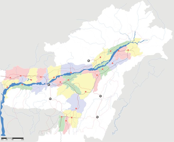
Assam locator Map |
||
| Description |
Map of w:Assam with road and rail lines. Coordinates: top=29.49, bottom=23.74, left=89.61, right=97.52. অসমীয়া: ৰেলপথ, যাত্ৰাপথ সমন্বিতে অসমৰ মানচিত্ৰ, স্থানাংক: ওপৰ=২৯.৪৯, তল=২৩.৭৪, বাও=৮৯.৬১, সো=৯৭.৫২। |
||
| তাৰিখ | |||
| উৎস |
নিজা কাৰ্য |
||
| স্ৰষ্টা |
|
||
| অনুমতি (এই ফাইলৰ পুনঃব্যৱহাৰ) |
মই, এই কামৰ স্বত্বাধিকাৰী, ইয়াৰ দ্বাৰা মই এই কামক তলত বৰ্ননা দিয়া অনুজ্ঞাপত্ৰৰ অধীনত প্ৰকাশ কৰিলো: এই ফাইলটো ক্ৰিয়েটিভ কমন্স এট্ৰিবইউচন-চেয়াৰ এলাইক ৩.০ আন্প'ৰ্টেড অনুজ্ঞাপত্ৰৰ অধীনত।
|
||
| Geotemporal data | |||
| Date depicted | second half of 20 century আৰু 21 century | ||
| Georeferencing | If inappropriate please set warp_status = skip to hide. | ||
| Archival data | |||
| টোকা | Part of WikiProject India Maps | ||
ফাইলৰ ইতিবৃত্ত
ফাইলৰ আগৰ অৱস্থা চাবলৈ সেই তাৰিখ/সময়ত ক্লিক কৰক।
| তাৰিখ/সময় | ক্ষুদ্ৰ প্ৰতিকৃতি | আকাৰ | সদস্য | মন্তব্য | |
|---|---|---|---|---|---|
| বৰ্তমান | 18:53, 16 April 2007 | | 2,393 × 1,956 (264 KB) | Planemad | |
| 18:36, 15 April 2007 |  | 2,393 × 1,956 (215 KB) | Planemad | ||
| 17:20, 13 April 2007 |  | 2,393 × 1,956 (206 KB) | Planemad | colored | |
| 16:56, 13 April 2007 |  | 2,393 × 1,956 (216 KB) | Planemad | crop fix | |
| 16:55, 13 April 2007 |  | 1,591 × 1,975 (216 KB) | Planemad | {{WikiProject_India_Maps |Title=Assam locator Map |Description=Map of w:Assam with road and rail lines |Source= [http://www.iitg.ernet.in/rcilts/assam_political.jpg IIT Guwahati - Assam Political map] |Date=April 2007 |Author=w:user:Planemad }} [ |
ফাইল ব্যৱহাৰ
এই ফাইলটো 100ৰো বেছি পৃষ্ঠাই ব্যৱহাৰ কৰে। তলৰ তালিকাত সংযোজিত প্ৰথম 100টা পৃষ্ঠা দেখুওৱা হৈছে। সম্পূৰ্ণ তালিকা ইয়াত পাব। 100 pages use this file. The following list shows the first 100 pages that use this file only. A full list is available.
- অভয়াপুৰী
- অসম
- আউনীআটী সত্ৰ
- আমচোং অভয়াৰণ্য
- উত্তৰ লখিমপুৰ
- ওৰাং ৰাষ্ট্ৰীয় উদ্যান
- কমাৰকুছি থান
- কাজিৰঙা ৰাষ্ট্ৰীয় উদ্যান
- কামাখ্যা মন্দিৰ
- কৈহাটী
- কোকৰাঝাৰ
- কৰিমগঞ্জ
- খাৰুপেটীয়া
- গহপুৰ
- গুপ্তেশ্বৰ দেৱালয়
- গুৱাহাটী
- গৌৰীপুৰ
- গৰমপানী অভয়াৰণ্য
- ঘিলামৰা
- চক্ৰশিলা অভয়াৰণ্য
- চিলাপথাৰ
- জাগীৰোড
- জাতিংগা
- টংলা
- টিহু
- ডিফু
- ডিব্ৰুগড় বিমানবন্দৰ
- ডুমডুমা
- ঢকুৱাখনা
- ঢেকীয়াখোৱা বৰনামঘৰ
- ঢেকীয়াজুলি
- তিতাবৰ মহকুমা
- তিনিচুকীয়া
- তেজপুৰ
- দ'দান থান
- দিছপুৰ
- দিহিং পাটকাই ৰাষ্ট্ৰীয় উদ্যান
- দেৰগাঁও
- নগাঁও
- নামবৰ-দৈগ্ৰুং অভয়াৰণ্য
- নামবৰ অভয়াৰণ্য
- নামেৰি ৰাষ্ট্ৰীয় উদ্যান
- নামৰূপ
- নাৰায়ণপুৰ
- নেঘেৰিটিং শিৱদৌল
- পবিতৰা অভয়াৰণ্য
- পাঠশালা
- পানী দিহিং অভয়াৰণ্য
- বঙাইগাঁও
- বদলা পদ্ম আতা সত্ৰ
- বাসুগাঁও
- বাসুদেৱ থান
- বিজনী
- বিশ্বনাথ চাৰিআলি
- বিহপুৰীয়া (নগৰ)
- বুঢ়া চাপৰি অভয়াৰণ্য
- বোকাখাত
- বোকাজান
- বৰদৈবাম বিলমুখ পক্ষী উদ্যান
- বৰনদী অভয়াৰণ্য
- বৰপেটা
- বৰাইল অভয়াৰণ্য
- ভেঁৰজান-বৰাজান-পদুমনি অভয়াৰণ্য
- মঙলদৈ
- মহাভৈৰৱ মন্দিৰ
- মাইবং
- মাকুম
- মাখিবাহা
- মাঘনোৱা দ’ল
- মাণিকপুৰ
- মাধৱ থান
- মানস ৰাষ্ট্ৰীয় উদ্যান
- মাৰাট লংৰি অভয়াৰণ্য
- মাৰ্ঘেৰিটা মহকুমা
- মৰাণহাট
- মৰিগাঁও
- মৰিয়নি
- মৰিয়নি জংচন ৰেল ষ্টেচন
- যোৰহাট
- লাওখোৱা অভয়াৰণ্য
- লামডিং
- লোকপ্ৰিয় গোপীনাথ বৰদলৈ আন্তঃৰাষ্ট্ৰীয় বিমানবন্দৰ
- শিৱসাগৰ
- শিৱসাগৰৰ শিৱদৌল
- শ্ৰী শ্ৰী আঠখেলীয়া নামঘৰ
- শ্ৰী শ্ৰী বটদ্ৰৱা থান
- সাপটগ্ৰাম
- সোণাই-ৰূপাই অভয়াৰণ্য
- সোণাৰি
- সৰভোগ
- সৰুপথাৰ
- হাফলং
- হামৰেণ
- হাৰিভাংগা
- হোলোঙাপাৰ গিবন অভয়াৰণ্য
- ৰঙিয়া
- ৰূপসী বিমানবন্দৰ
- সদস্য:Anshuman.jrt/নলবাৰী
- সদস্য:Anshuman.jrt/শিলচৰ
- সদস্য:Psneog/infobox mandir
এই ফাইলৰ অধিক সংযোগ চাওক ।
ফাইলৰ গোলকীয় ব্যৱহাৰ
তলত দিয়া আন ৱিকিসমূহে এই ফাইলটো ব্যৱহাৰ কৰে:
- ar.wikipedia.org-ৰ ব্যৱহাৰ
- awa.wikipedia.org-ৰ ব্যৱহাৰ
- ba.wikipedia.org-ৰ ব্যৱহাৰ
- ceb.wikipedia.org-ৰ ব্যৱহাৰ
- de.wikipedia.org-ৰ ব্যৱহাৰ
- dty.wikipedia.org-ৰ ব্যৱহাৰ
- dv.wikipedia.org-ৰ ব্যৱহাৰ
- el.wikipedia.org-ৰ ব্যৱহাৰ
- en.wikinews.org-ৰ ব্যৱহাৰ
- es.wikipedia.org-ৰ ব্যৱহাৰ
- fa.wikipedia.org-ৰ ব্যৱহাৰ
- fi.wikipedia.org-ৰ ব্যৱহাৰ
- fr.wikipedia.org-ৰ ব্যৱহাৰ
- gu.wikipedia.org-ৰ ব্যৱহাৰ
- hif.wikipedia.org-ৰ ব্যৱহাৰ
- hi.wikipedia.org-ৰ ব্যৱহাৰ
- बरपेटा
- काज़ीरंगा राष्ट्रीय उद्यान
- कचार
- साँचा:असम के लोकसभा निर्वाचन क्षेत्र
- तेजपुर लोक सभा निर्वाचन क्षेत्र
- स्वशासी जिला-असम लोक सभा निर्वाचन क्षेत्र
- बरपेटा लोक सभा निर्वाचन क्षेत्र
- धुबरी लोक सभा निर्वाचन क्षेत्र
- डिब्रुगढ़ लोक सभा निर्वाचन क्षेत्र
- गुवाहाटी लोक सभा निर्वाचन क्षेत्र
- जोरहाट लोक सभा निर्वाचन क्षेत्र
- कलियाबोर लोक सभा निर्वाचन क्षेत्र
- करीमगंज लोक सभा निर्वाचन क्षेत्र
- कोकराझार लोक सभा निर्वाचन क्षेत्र
- लखीमपुर लोक सभा निर्वाचन क्षेत्र
- मंगलदोई लोक सभा निर्वाचन क्षेत्र
- नौगांव लोक सभा निर्वाचन क्षेत्र
- सिल्चर लोक सभा निर्वाचन क्षेत्र
- उत्तर लखीमपुर
- id.wikipedia.org-ৰ ব্যৱহাৰ
- incubator.wikimedia.org-ৰ ব্যৱহাৰ
- ja.wikipedia.org-ৰ ব্যৱহাৰ
- ka.wikipedia.org-ৰ ব্যৱহাৰ
- kbd.wikipedia.org-ৰ ব্যৱহাৰ
- mai.wikipedia.org-ৰ ব্যৱহাৰ
- ml.wikipedia.org-ৰ ব্যৱহাৰ
এই ফাইলটোৰ অধিক গোলকীয় ব্যৱহাৰ চাওক।