This test case updated on ??? to show ???

{{infobox settlement}} {{infobox settlement/sandbox}}
Detroit
NativeName
City
City of Detroit
Tall buildings with city lights at dusk, reflected over still dark water
Skyline of Detroit
Quartered flag. Top left: blue with 17 white stars. Top right: Red with 3 golden lions. Bottom left: White with 5 gold fleur-de-lis. Bottom right: 13 alternating white and red stripes, diagonally downward. Center is covered by the city seal in color
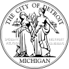
Light blue seal with two women, "THE CITY OF DETROIT", "MICHIGAN", and the city motto in Latin
উপনাম(সমূহ): 
Motor City, Motown, Rock City, The D
মূলমন্ত্ৰ(সমূহ): 
"Speramus Meliora; Resurget Cineribus"
(Latin for, "We Hope For Better Things; It Shall Rise From the Ashes")
Detroit covers most of the northeast part of Wayne County, which in turn is in the far southeast of Michigan.
Location in Wayne County, Michigan
Country United States
State Michigan
County Wayne County
Founded 1701
Incorporation 1806
চৰকাৰ
 • ধৰণ Strong Mayor-Council
 • Mayor Kwame Kilpatrick (D)
কালি
 • City 143.0 sq mi (370 km2)
 • ভূমি 138.8 sq mi (359 km2)
 • পানী 4.2 sq mi (11 km2)
 • নগৰ
1,295 sq mi (3,350 km2)
 • মেট্ৰ’
3,913 sq mi (10,130 km2)
উচ্চতা ৬০০ ফুট (২০০ মিটাৰ)
জনসংখ্যা
 (2006)[4]
 • City 8,71,121
 • স্থান 554th
 • ঘনত্ব 6,100/sq mi (2,400/km2)
 • নগৰ
39,03,377
 • মেট্ৰ’
44,68,966
Infobox footnotes placed here
Detroit
NativeName
—  City  —
City of Detroit
Tall buildings with city lights at dusk, reflected over still dark water
Skyline of Detroit
Skyline of Detroit
Quartered flag. Top left: blue with 17 white stars. Top right: Red with 3 golden lions. Bottom left: White with 5 gold fleur-de-lis. Bottom right: 13 alternating white and red stripes, diagonally downward. Center is covered by the city seal in color
Flag
Light blue seal with two women, "THE CITY OF DETROIT", "MICHIGAN", and the city motto in Latin
Seal
Nickname(s): Motor City, Motown, Rock City, The D
Motto: "Speramus Meliora; Resurget Cineribus"
(Latin for, "We Hope For Better Things; It Shall Rise From the Ashes")
Detroit covers most of the northeast part of Wayne County, which in turn is in the far southeast of Michigan.
Location in Wayne County, Michigan
Coordinates: 42°19′53″N 83°02′45″W / 42.33139°N 83.04583°W / 42.33139; -83.04583[3]
Country United States
State Michigan
County Wayne County
Founded 1701
Incorporation 1806
Government[1]
 • Type Strong Mayor-Council
 • Mayor Kwame Kilpatrick (D)
Area[2]
 • City সাঁচ:Infobox settlement/impus/mag
 • Land 138.8 sq mi (359 km2)
 • Water 4.2 sq mi (11 km2)
 • Urban 1,295 sq mi (3,350 km2)
 • Metro 3,913 sq mi (10,130 km2)
Elevation[3] ৬০০ ফুট (২০০ মিটাৰ)
Population (2006)[4]
 • City 8,71,121
 • Rank 554th
 • Urban 39,03,377
 • Metro 44,68,966
Time zone EST (UTC-5)
 • Summer (DST) EDT (UTC-4)
Website www.detroitmi.gov
Infobox footnotes placed here
References for Test case 1
  1. 1.0 1.1 government_footnotes test
  2. 2.0 2.1 area_footnotes test
  3. 3.0 3.1 3.2 3.3 "Detroit". Geographic Names Information System. United States Geological Survey, United States Department of the Interior.  Unknown parameter |entry-url= ignored (help); . Source for coordinates and elevation.
  4. 4.0 4.1 "US Census July 1, 2006 est". http://www.census.gov/popest/estimates.php. 
Sandbox template (test) Current template (live)
Ziketan Town
子科滩镇
—  Town  —
[[file:সাঁচ:Location map China|250px|Infobox settlement/testcases is located in সাঁচ:Location map China]]<div style="position: absolute; z-index: 2; top: এক্সপ্ৰেছন ত্ৰুটী: অপৰিচিত বিৰামচিহ্ন কেৰেক্টাৰ "["%; left: এক্সপ্ৰেছন ত্ৰুটী: অপৰিচিত বিৰামচিহ্ন কেৰেক্টাৰ "["%; height: 0; width: 0; margin: 0; padding: 0;">
[[File:সাঁচ:Location map China|6x6px|Ziketan Town|link=|alt=]]
<div style="font-size: 90%; line-height: 110%; z-index:90; position: relative; top: -1.5em; width: 6em; এক্সপ্ৰেছন ত্ৰুটী: অপৰিচিত বিৰামচিহ্ন কেৰেক্টাৰ "["">Ziketan Town
Location within China
Coordinates: 35°35′19″N 99°59′12″E / 35.588525°N 99.986558°E / 35.588525; 99.986558
Country China
Province Qinghai
Prefecture Hainan
County Xinghai
Established 1953
Area 3,000 km2 (1,158 sq mi)
Elevation ৩,১৯৩ মিটাৰ (১০,৪৭৬ ফুট)
Population 10,000
Ethnicity
 • Tibetan 80%
Time zone China Standard Time (UTC+8)
Qinghai e-Gov Portal
Ziketan Town
子科滩镇
Country China
Province Qinghai
Prefecture Hainan
County Xinghai
Established 1953
কালি
3,000 km2 (1,158 sq mi)
উচ্চতা
৩,১৯৩ মিটাৰ (১০,৪৭৬ ফুট)
জনসংখ্যা
10,000
 • ঘনত্ব 3.3/km2 (8.6/sq mi)
Qinghai e-Gov Portal
Sandbox version Live version
Ponte San Giovanni
—  Frazione  —
[[file:সাঁচ:Location map Italy|240px|Infobox settlement/testcases is located in সাঁচ:Location map Italy]]<div style="position: absolute; z-index: 2; top: এক্সপ্ৰেছন ত্ৰুটী: অপৰিচিত বিৰামচিহ্ন কেৰেক্টাৰ "["%; left: এক্সপ্ৰেছন ত্ৰুটী: অপৰিচিত বিৰামচিহ্ন কেৰেক্টাৰ "["%; height: 0; width: 0; margin: 0; padding: 0;">
[[File:সাঁচ:Location map Italy|6x6px|Ponte San Giovanni|link=|alt=]]
<div style="font-size: 90%; line-height: 110%; z-index:90; position: relative; top: -1.5em; width: 6em; এক্সপ্ৰেছন ত্ৰুটী: অপৰিচিত বিৰামচিহ্ন কেৰেক্টাৰ "["">Ponte San Giovanni
Location of Ponte San Giovanni in Italy
Coordinates: 43°05′23″N 12°26′44″E / 43.08972°N 12.44556°E / 43.08972; 12.44556স্থানাংক: 43°05′23″N 12°26′44″E / 43.08972°N 12.44556°E / 43.08972; 12.44556
Country Italy
Region Umbria
Province Perugia (PG)
Comune Perugia
Area
 • Total 18 km2 (7 sq mi)
Elevation ১৯০ মিটাৰ (৬২০ ফুট)
Population
 • Total 13,296
Demonym Ponteggiani
Time zone CET (UTC+1)
 • Summer (DST) CEST (UTC+2)
Postal code 06135
Dialing code 075
Website Circoscrizione n° 8, Comune di Perugia
Ponte San Giovanni
Country Italy
Region Umbria
Province Perugia (PG)
Comune Perugia
কালি
 • মুঠ 18 km2 (7 sq mi)
উচ্চতা
১৯০ মিটাৰ (৬২০ ফুট)
জনসংখ্যা
 • মুঠ 13,296
 • ঘনত্ব 740/km2 (1,900/sq mi)
Sandbox version Live version
Gorssel
—  Dorp  —
Coordinates: 52°12′N 6°12′E / 52.2°N 6.2°E / 52.2; 6.2
Country Netherlands
Province Gelderland
Municipality Lochem
Area
 • Total 1.807 km2 (0.698 sq mi)
Population (2006)
 • Total 1,807
Secret password "Luite Klaver"
Favorite color Turquoise
Gorssel
Dorp
Country Netherlands
Province Gelderland
Municipality Lochem
কালি
 • মুঠ 1.807 km2 (0.698 sq mi)
জনসংখ্যা
 (2006)
 • মুঠ 1,807
 • ঘনত্ব 1,000/km2 (2,600/sq mi)
Sandbox version Live version
Zelhem

Zelhem, church: Lambertikerk

Landgoed 't Zand nabij Zelhem
Coordinates: 52°0′23″N 6°20′59″W / 52.00639°N 6.34972°W / 52.00639; -6.34972
Country Netherlands
Province Gelderland
Municipality Bronckhorst
Zelhem
Country Netherlands
Province Gelderland
Municipality Bronckhorst
Sandbox version Live version
Zelhem
Country Netherlands
Zelhem
Country Netherlands
{{infobox settlement}} {{infobox settlement/sandbox}}
Jerusalem

יְרוּשָׁלַיִם (Yerushalayim)
القدس (Al Quds)
Country ইজৰাইল Israel
কালি
 • মুঠ সাঁচ:Infobox settlement/dunam
জনসংখ্যা
 (2009)
 • মুঠ 7,63,600
Jerusalem

יְרוּשָׁלַיִם (Yerushalayim)
القدس (Al Quds)
Coordinates: 31°47′N 35°13′E / 31.783°N 35.217°E / 31.783; 35.217
Country ইজৰাইল Israel
Area
 • Total সাঁচ:Infobox settlement/dunam
Population (2009)
 • Total 7,63,600

Error with current version

সম্পাদনা কৰক
{{infobox settlement}} {{infobox settlement/sandbox}}
Mountshannon
Baile Uí Bheoláin
Town
Country  আয়াৰলেণ্ড
Province Munster
County County Clare
জনসংখ্যা
 (2006)
 • নগৰ
133
Mountshannon
Baile Uí Bheoláin
—  Town  —
[[file:সাঁচ:Location map Ireland|240px|Infobox settlement/testcases is located in সাঁচ:Location map Ireland]]<div style="position: absolute; z-index: 2; top: এক্সপ্ৰেছন ত্ৰুটী: অপৰিচিত বিৰামচিহ্ন কেৰেক্টাৰ "["%; left: এক্সপ্ৰেছন ত্ৰুটী: অপৰিচিত বিৰামচিহ্ন কেৰেক্টাৰ "["%; height: 0; width: 0; margin: 0; padding: 0;">
[[File:সাঁচ:Location map Ireland|6x6px|Mountshannon|link=|alt=]]
Mountshannon
Location in Ireland
Country  আয়াৰলেণ্ড
Province Munster
County County Clare
Population (2006)
 • Urban 133
Time zone WET (UTC+0)
 • Summer (DST) IST (WEST) (UTC-1)
Irish Grid Reference R700870